Amelia: A framework for airport surface movement
Amelia is a framework for airport surface movement consisting of toolkit for collecting an processing our large-scale dataset, and for building and training motion forecasting models.
We release this toolkit to encourage research in this domain! Below we provide an overview of our toolkit.
Notes:
- For more details on how to download and use our dataset, go to Amelia-42
- For more details on our trajectory forecasting model, go to Amelia-TF
- For even more details, please check out our paper!
Overview of Our Framework
Our framework consists of 7 tools for processing, analyzing, visualizing and characterizing trajectory and map data for airport surface operations.
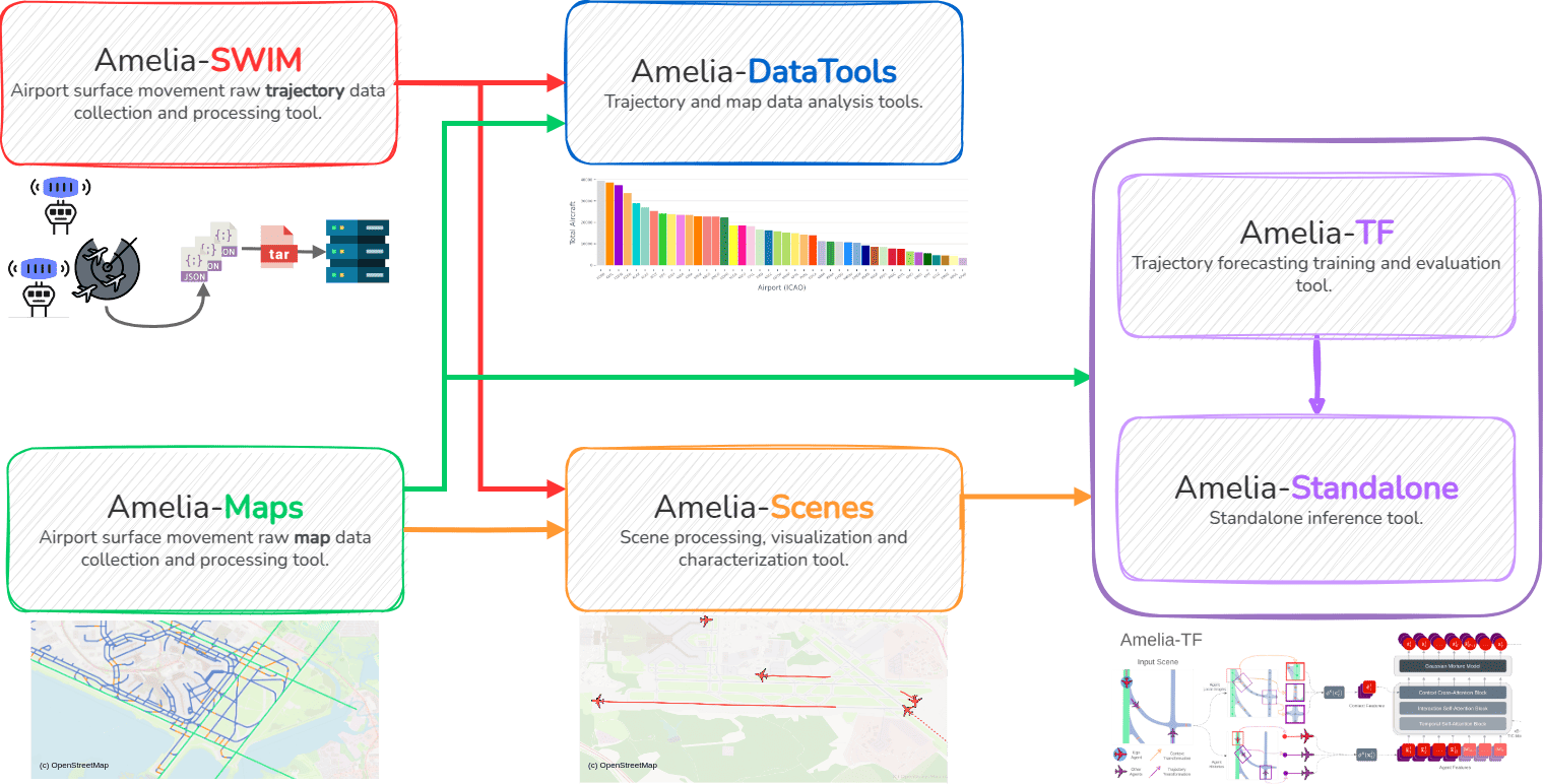
Tools
Amelia-SWIM
Amelia-SWIM is a tool that uses the System Wide Information Management (SWIM) program to collect position reports for aircraft and vehicles operating within 42 US airports.
The tool produces clean, interpolated data in formats accepted by most recent ML-based trajectory forecasting dataloaders. The collected position reports cover both, approaching and ground movement events which are saved into hourly CSV files containing the following information:
Amelia-Maps
We use the Amelia-Maps tool to collect and produce airport surface maps.
The tools converts OpenStreetMap (OSM) maps into light-weight, graph-based semantic maps through a series of automated steps that involve a) obtaining the raw graphs from OSM, b) filtering out irrelevant regions and assigning semantic labels for regions of interest, c) extending regions of interest, d) supersampling for obtaining a finer granularity, and e) obtaining the final data representation.

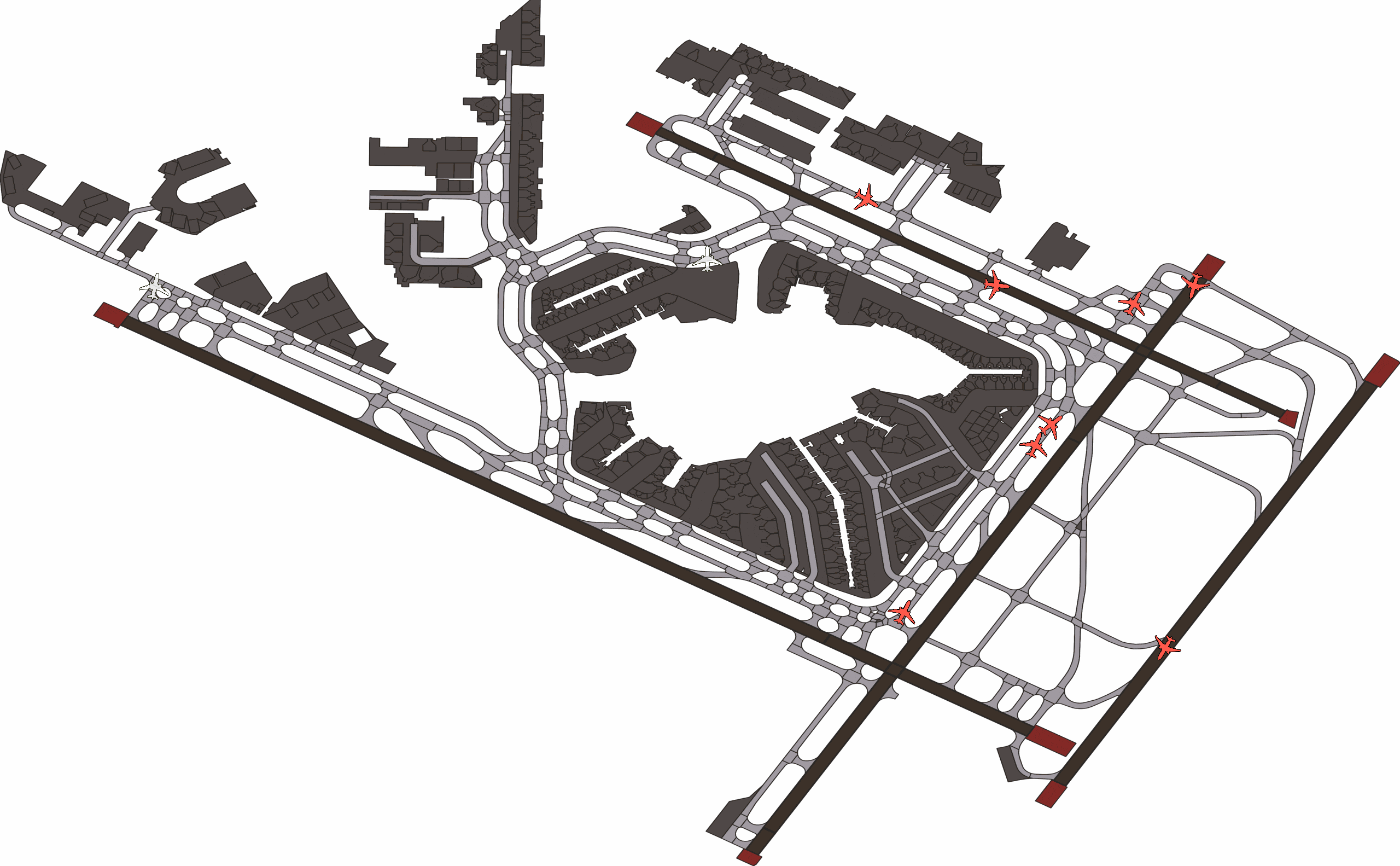
Amelia-DataTools
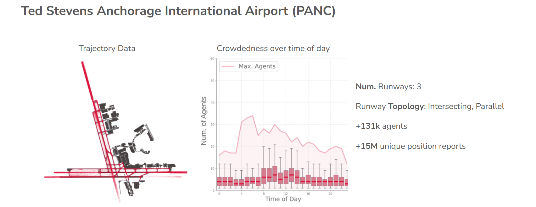
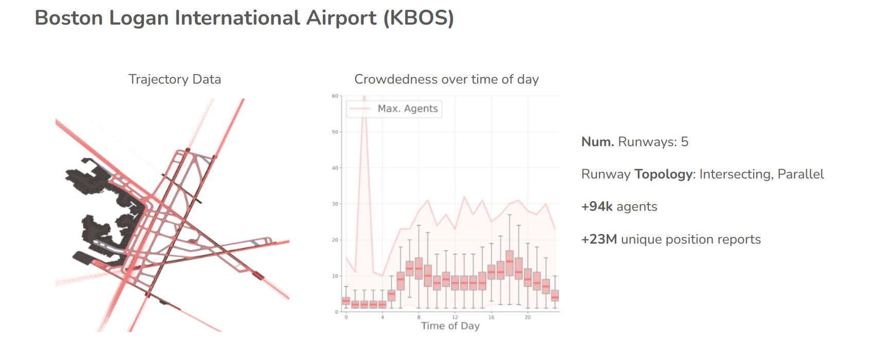
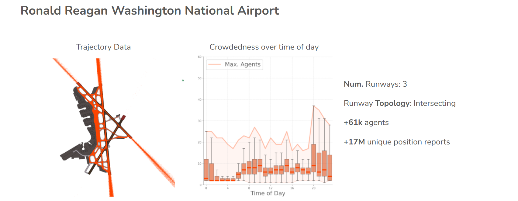
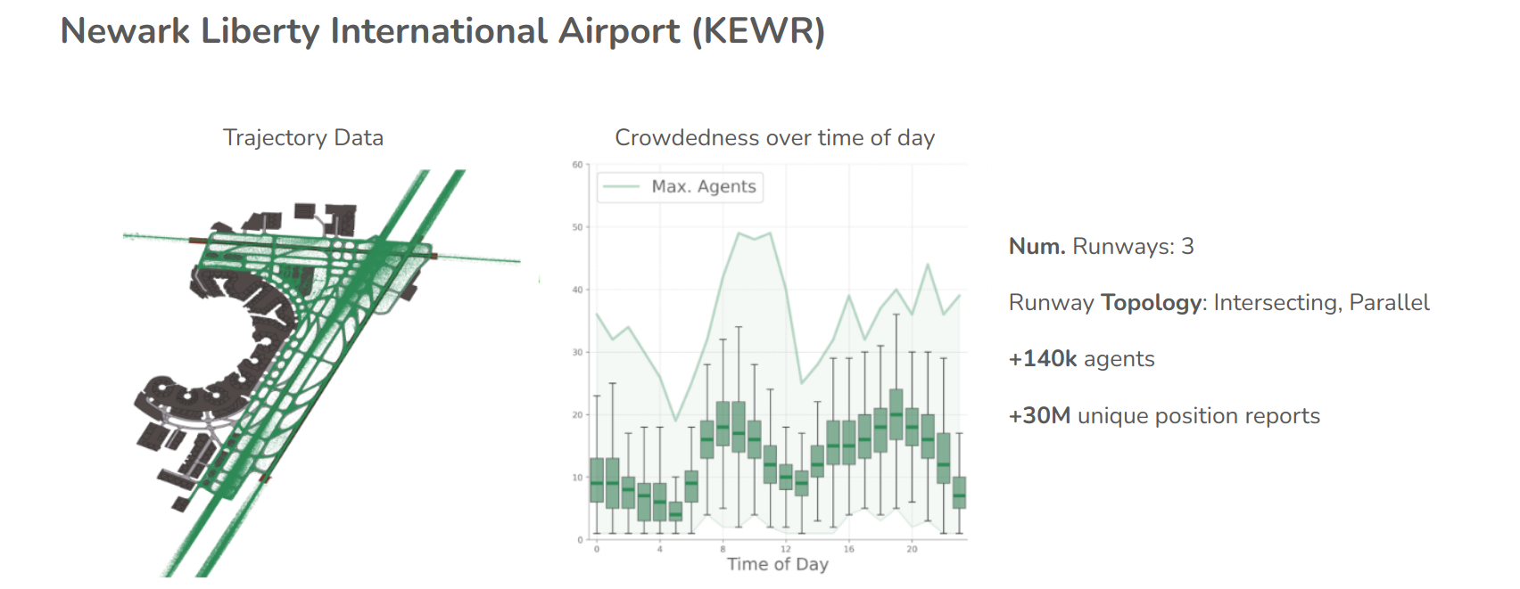
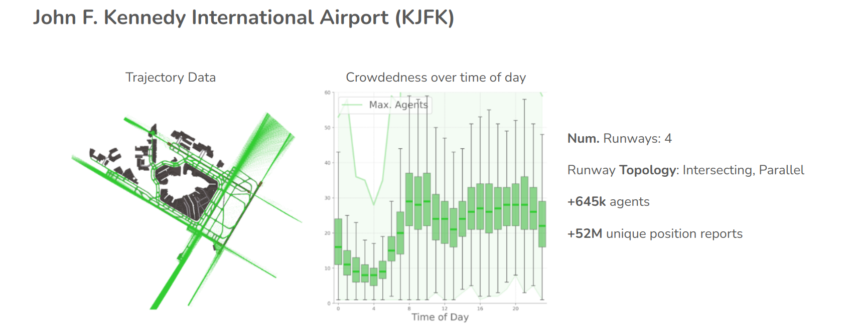
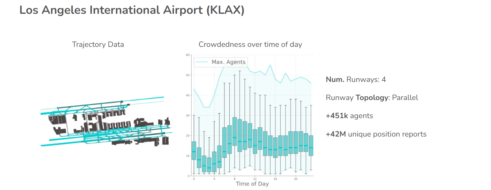
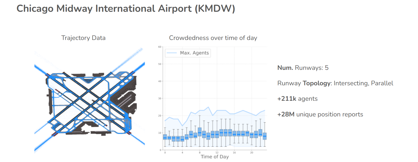
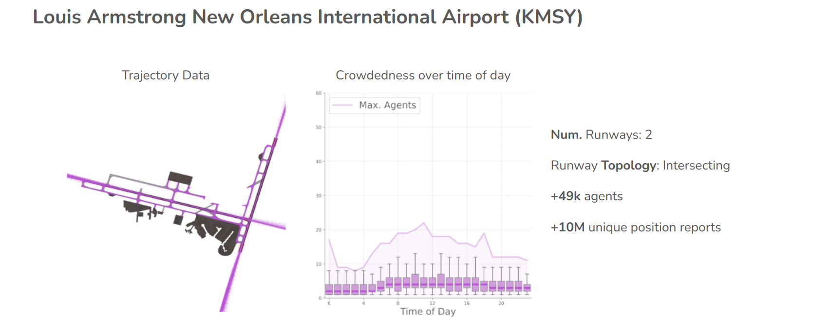
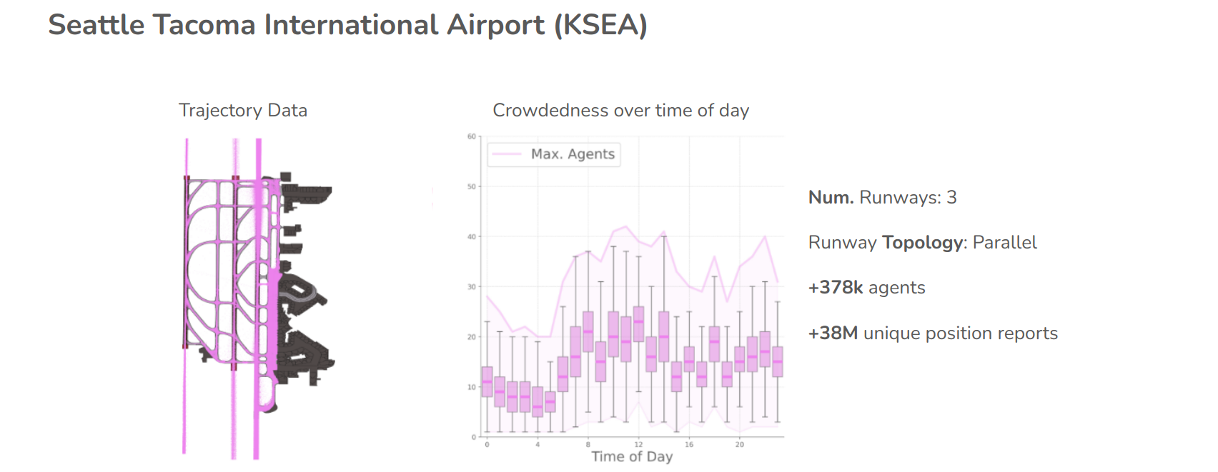
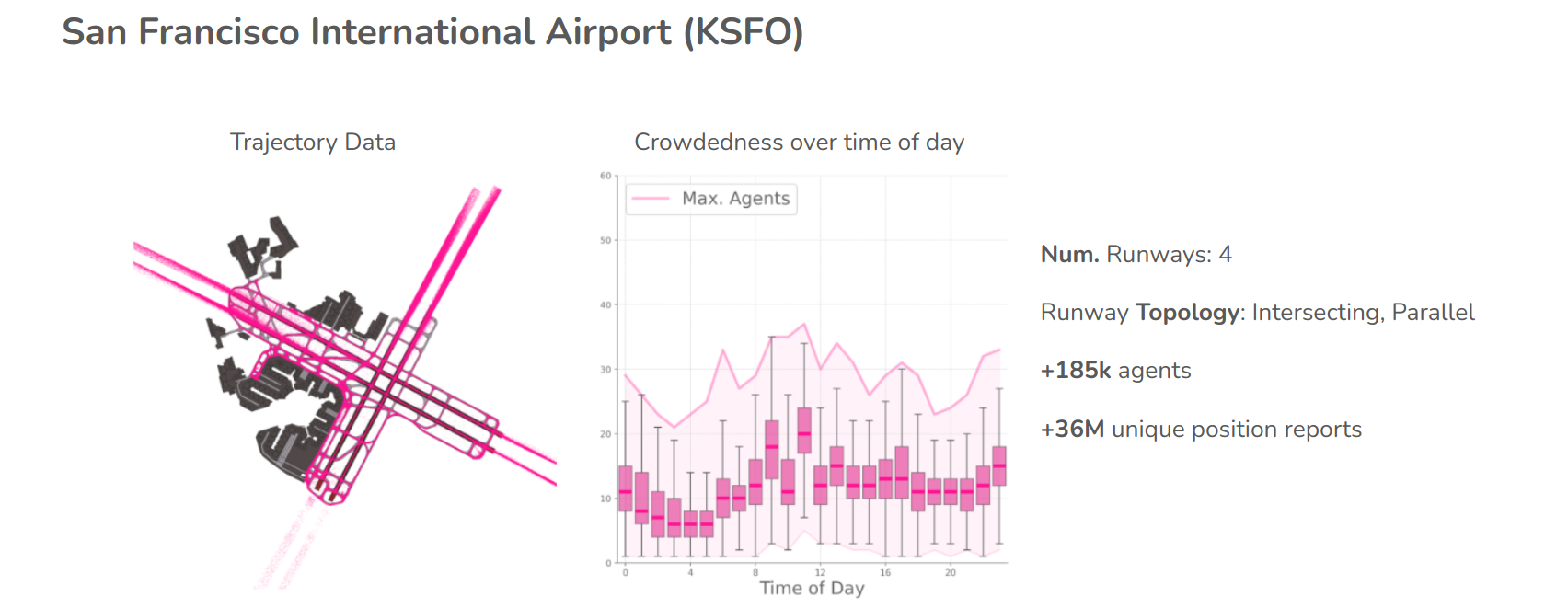
We provide Amelia-DataTools to validate and analyze our collected and pre-processed data via a set of scripts that provide visualizations and data statistics.
As an initial step, we validate and analyze the trajectory and map data for 10 airports with varying topological complexity and crowdedness:
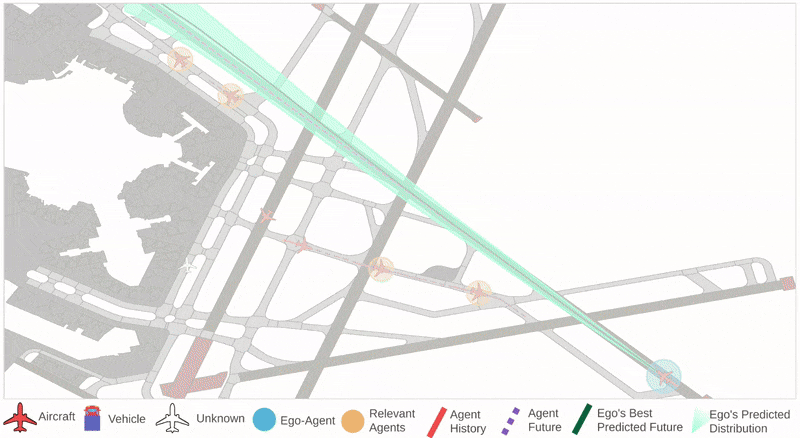
Amelia-Scenes
We use Amelia-Scenes to extract scenes from the raw CSV files. Our scene extraction is easily configurable to obtain different types of scenes in terms of number of agents of interest, scene length, and point-to-point granularity.
We also provide scene characterization tools to analyze scene complexity w.r.t individual agent kinematic profiles, as well as level of agent-to-agent interactivity and crowdedness.
| Boston Logan International Airport (KBOS) | John F. Kennedy International Airport (KJFK) | 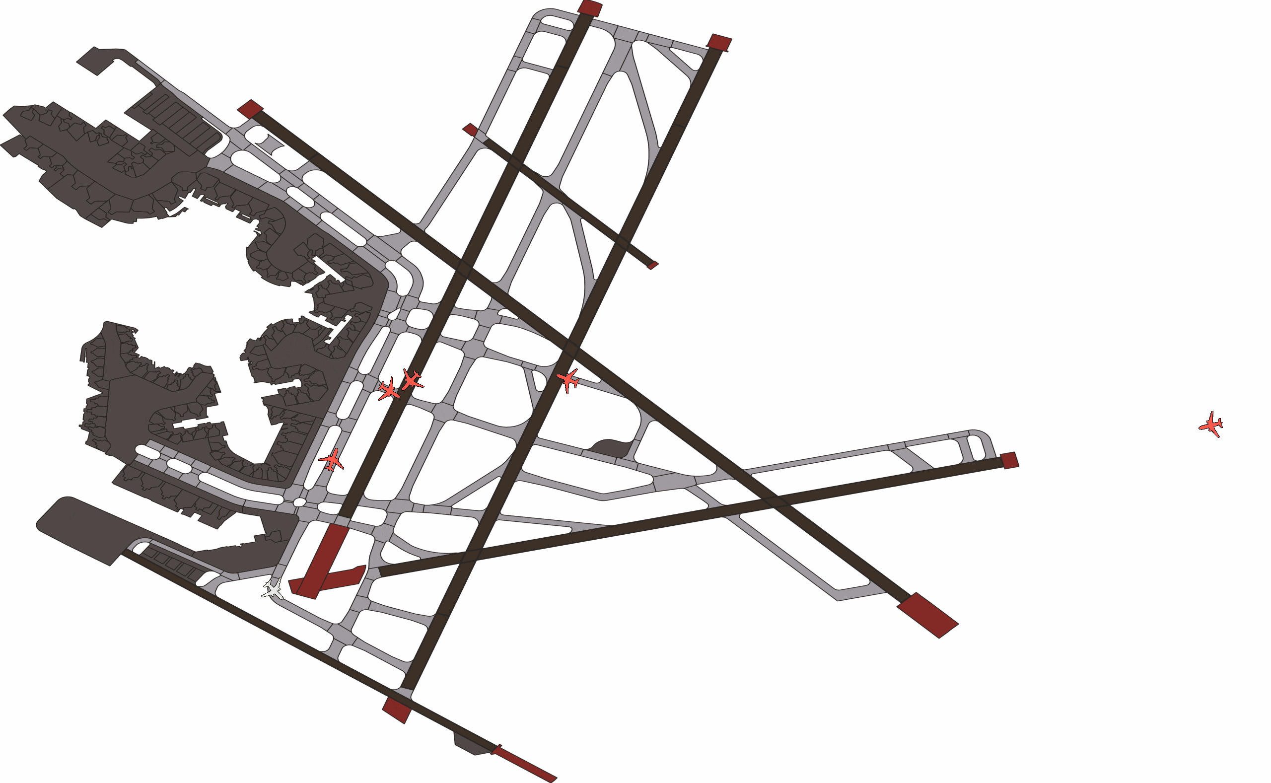 |
 |
The resulting scenes can be used for several downstream tasks such as trajectory forecasting For example:
We provide scripts for creating visualizations for ground truth scenes and model predictions.
 |
 |
Amelia-TF
We provide, Amelia-TF, a framework for training and evaluating trajectory forecasting models that uses Hydra + Pytorch Lightning. This framework enables easy integration and implementation of existing and new models.
For more details on our proposed model, check out Amelia-TF!
Amelia-Inference
Finally, we also release an inference tool for visualizing model predictions.
BibTeX
If you find our work useful in your research, please cite us!
@inbook{navarro2024amelia,
  author = {Ingrid Navarro and Pablo Ortega and Jay Patrikar and Haichuan Wang and Zelin Ye and Jong Hoon Park and Jean Oh and Sebastian Scherer},
  title = {AmeliaTF: A Large Model and Dataset for Airport Surface Movement Forecasting},
  booktitle = {AIAA AVIATION FORUM AND ASCEND 2024},
  chapter = {},
  pages = {},
  doi = {10.2514/6.2024-4251},
  URL = {https://arc.aiaa.org/doi/abs/10.2514/6.2024-4251},
  eprint = {https://arc.aiaa.org/doi/pdf/10.2514/6.2024-4251},
}